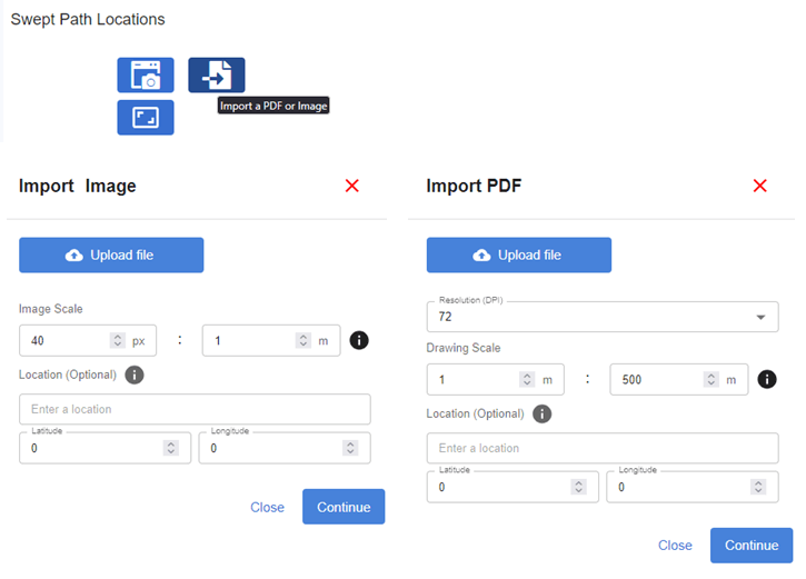
Importing a PDF or Image as a Location
You can also import an image or PDF to use as the background of the Swept Path.
You will need to know the scale of the image for it to be useful.
Location is optional, it will just add a marker on the map only if you do fill it out to show where your swept path location is.
To import it, the button is located on the right next to the screenshot button.
For Images you will need to know how many pixels per meter. This can be done if your image has a scale or a object with a known length, you can measure it in Microsoft Paint and calculate the scale.
For a PDF, it is assumed that it's more of a drawing with a scale, and the scale of 1m on the PDF page to how many meters in real life.
The scale is important to get right as it affects the vehicle's size.